Google expands experimental access to its geospatial reasoning agent
A new Earth AI report combines specialized models, spatial tools and planning, with early access through Google Earth and an agent API.
THE STORY IN THREE POINTS
- Google published a new technical report on October 14.
- Experimental access is expanding through Ask Google Earth and an A2A service.
- The agent can combine specialist models and users’ spatial datasets.
The research update
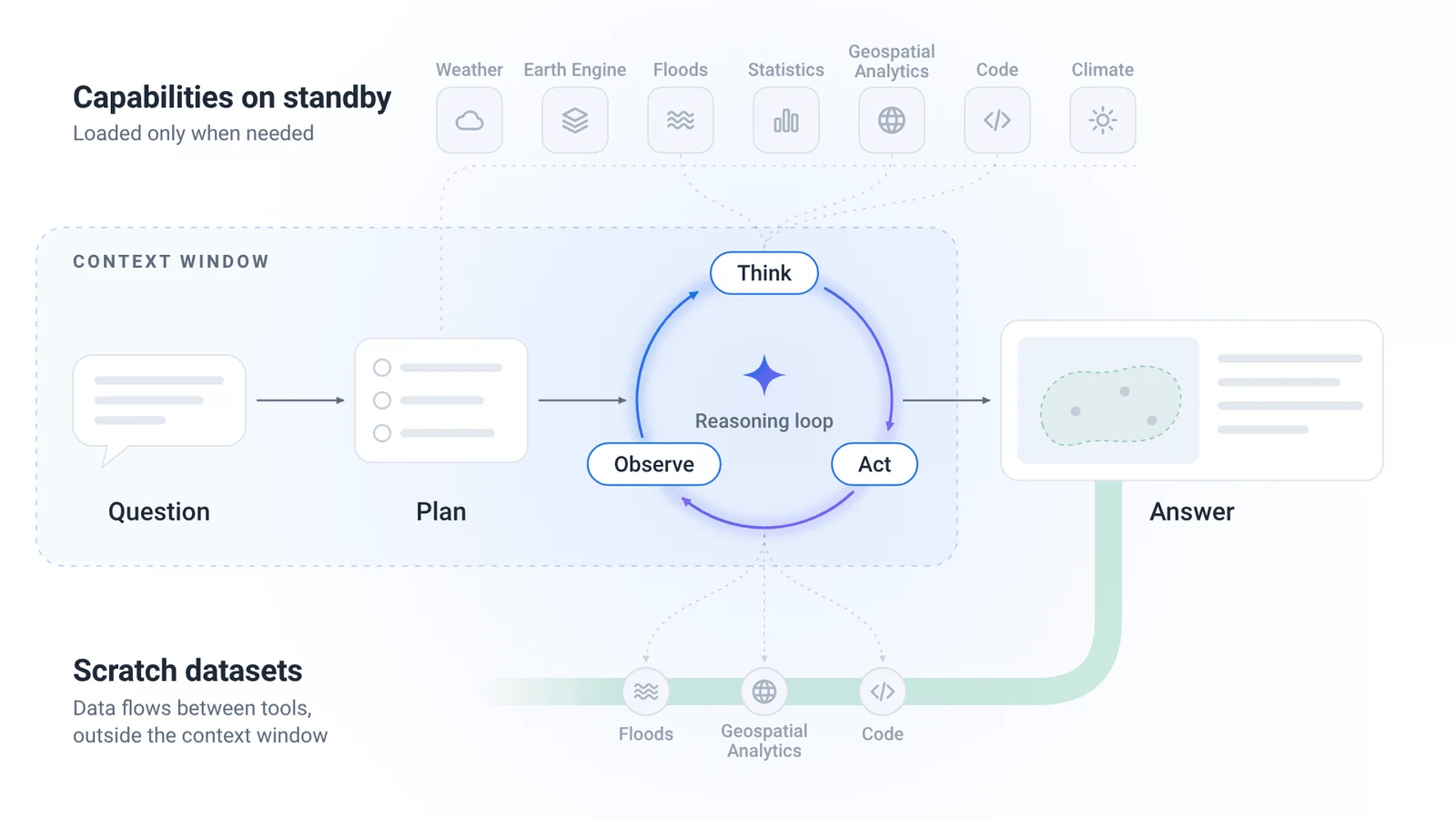
Google Research described an experimental Geospatial Reasoning agent that combines Earth AI models, spatial tools and advance planning. The company published a technical report and said early access is expanding through Ask Google Earth and an agent-to-agent API.
The system can incorporate users’ datasets and exposes plans and data sources for review. Google reports partner tests and benchmark results, while continuing to describe the service as experimental.
Editorial context: a map needs inspectable assumptions
An analysis of flood exposure or access to services depends on boundaries, dates and the resolution of each dataset. A plausible map can still answer a different question from the one a planner intended to ask.
A useful review would let a specialist replace a dataset or alter a boundary and see how the conclusion changes. That would make the analytical choices visible rather than presenting the final visualization as self-explanatory evidence.
Editorial outlook: what to watch
The next evidence should show reproducible analyses across places with different levels of data coverage.
Reports should identify uncertainty and the effects of substituting missing local information. Such detail would help organizations understand where an agent saves analytical effort and where expert interpretation remains essential.
Sources: Google Research: Putting Earth AI to work: Geospatial agents for our planet’s biggest challenges ↗